CIVIL 3D TRAINING (Road Design Essential)
AutoCAD Civil 3D Training Center - Myanmar ကနေပြီး AutoCAD Civil 3D 2018 Version ကို အသုံးပြုလျှက် Online Class ဖွင့်လှစ်သင်ကြားပေးနေပါတယ်ခင်ဗျာ။
ဘယ်သူတွေ တက်သင့်လဲ?
More Prefer for Civil Engineer, Surveyor , Quantity Surveyor or Estimator
Civil Engeinnering နယ်ပယ်ဖြစ်တဲ့ လမ်းလုပ်ငန်း၊ မြို့ကွက်ဖော်ထုတ်ခြင်းလုပ်ငန်း ၊ ဆည်မြောင်းတာတမံ ရေစီးရေလာလုပ်ငန်း ၊ မြေသားလုပ်ငန်းတွက်ချက်ခြင်းတို့ အတွက် များစွာအသုံးဝင်တဲ့ အတွက် လမ်းဖောက်လုပ်ရေးအင်ဂျင်နီယာများ ၊ ဆည်မြောင်း နဲ့ မြေတိုင်းပညာရှင်များ တက်ရောက်ကြတာ များပါတယ်။ Dredging Volume တွက်ဖို့ဆိုပြီး စင်ကာပူ သင်္ဘောကျင်း မှာ အလုပ်လုပ်နေတဲ့ မြန်မာအင်ဂျင်နီယာတယောက်လည်း လာတက်ခဲ့ပါတယ်။ irregular shape ဖြစ်တဲ့ မြေကြီးလုပ်ငန်းတွက်ချက်ရာမှာ အများကြီး လွယ်ကူလျင်မြန်တာကြောင့် မြို့ပြလုပ်ငန်းနှင့် ဆက်နွယ်နေတဲ့ Quantity Surveyor များလည်း တက်ရောက်သင့်ပါတယ်။ ဂျပန်မှာ အလုပ်လုပ်ကိုင်နေတဲ့ မြန်မာအင်ဂျင်နီယာများကတော့ လမ်းလုပ်ငန်းခွင်လိုအပ်ချက်အရ တက်ရောက်သင်ကြားကြပါတယ်။
ဘယ်လို သင်ကြားရမှာလဲ?
Google Classroom ကို အသုံးပြုထားတာကြောင့် အင်တာနက်ရှိရုံနဲ့ ဘယ်နေရာကမဆို သင်ယူနိုင်တဲ့ အားသာချက် ရှိပြီး မရှင်းလင်းသည်များကိုလည်း Viber Group မှာ မေးနိုင်တာကြောင့် အပြင်သင်တန်းနဲ့ မကွာခြားပါဘူးခင်ဗျာ။ သင်ခန်းစာ recording video များ နှင့် လေ့ကျင့်ခန်းဖိုင်များကို download ဆွဲယူခွင့်ပေးထားတာကြောင့် learn at yourself paced မိမိအားလပ်တဲ့အချိန် ၊ မိမိ အဆင်ပြေသလို လေ့လာသင်ယူနိုင်ပါတယ်။ သင်ရိုးမာတိကာ ကို အောက်ပါအတိုင်း ရေးဆွဲထားပြီးတော့ ထပ်မံထည့်သွင်း သင်ကြားစေလိုသည်များကိုလည်း တောင်းဆိုထားနိုင်ပါတယ်။ ဖုန်းနံပါတ် 09-977108606 သို့ ဆက်သွယ်စုံစမ်းနိုင်ပါတယ်ခင်ဗျာ ။ အဆိုပါဖုန်းသို့ Viber မှ တဆင့်လည်း ဆက်သွယ်စုံစမ်းနိုင်ပါတယ်။ အီးမေးလ်လိပ်စာ learnc3dmm@gmail.com သို့လည်း ဆက်သွယ်နိုင်ပါတယ်။ အားလုံး ကျန်းမာချမ်းသာ လိုရာဆန္ဒပြည့်ဝကြပါစေခင်ဗျာ။ တကယ်လို့ သင်တန်းတက်ရောက်ဖို့စာရင်းပေးမယ်ဆိုရင် အောက်ကလင့် ကနေလည်း စာရင်းသွင်းနိုင်ပါတယ်ခင်ဗျာ ။
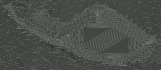
AutoCAD Civil3D Essential Training Course
(Oriented for Road Design)
1.Understanding User Interface
- v Application Menu
- v Quick Access Toolbar
- v Ribbon, Panels and Tabs
2.Survey
- v Survey Database,
- v Import Field Survey Data
- v Understanding Linework Codeset and Automatic Linework
3.Points and Point Groups
- v Importing Field Survey Data Points
- v Point Group Creating
- v Manipulating Points and Label Display Style
4.Surface Creation
- v Create Surface from Point Group
- v Create Surface from Points File
- v Manipulating Surface Style
- v Labelling Surface
5.Alignment
- v Understanding Alignment Constraints
- v Alignment Creation & Labelling
- v Alignment Editing
6.Profiles and Profile Views
- v Type of Profiles
- v Surface Profile and Profile View Creation
- v Design Profile Creation
- v Profile Labelling
7.Assembly and Sub-assembly
- v Understanding Assembly and Sub-assembly
- v Assembly Creation
8. Corridor
- v Requirements Of Corridor
- v Corridor Region, Frequency and Targeting
- v Creation of Basic Corridor
9. Cross Section , Section View and Earthwork Calculation
- v Sample Lines
- v Structure of Section View
- v Create Cross Section and Section View
- v Calculate Earthwork by Average End Area Method
- v Create Earthwork Volume Table
10. Super-Elevation
- v Requirements To Apply Super
- v Compute Superelevation
- v Superelevation View
11. Section, Plan, Profile Sheet Set
- v Benefits of Section Sheet Set
- v View-Frames and Match-Lines
- v Create A3 Section, Plan Profile Sheet Set
12. Assignment Submit and Review (assignment ပြီးဆုံး၍ ရမှတ် ၅၅ နဲ့ အထက်ဆိုပါက သင်တန်းဆင်းလက်မှတ် ထုတ်ပေးသွားမှာ ဖြစ်ပါတယ်)
#Mastering #Civil3D #Training #Engineer #Surveyor #Infrastructure #Road #Dam #Irrigation #Canal #Earthwork #Layout #Planning #Urban #Drainage #Grading #Myanmar #AutoCAD #Alignment #Surface #Contour #Profile #Corridor #Units #Tutorial #drawing #setting #Zone #transformation #Save #elearning #onlineclass


Comments
Post a Comment